

-
-
-
-
About Upazila
Introduce to Upazila
History & Tradition
Geographical and Economic
-
Upazila Council
Chairman of Upozila PariShod
About Upozila Parishod
Annual Development Program Report
Work description of the concerned committee of the upazila
- Upazila Law and Order Affairs Committee
- Physical Infrastructure Development Matters Committee
- Upazila Agriculture and Irrigation Committee
- Upazila Secondary and Madrasa Education Affairs
- Upazila Primary and Mass Education Affairs Committee
- Upazila Health and Family Welfare Affairs Committee
- Upazila Youth and Sports Development Affairs Committee
- Upazila Women and Child Development Affairs Committee
- Upazila Social Welfare Affairs Committee
- Upazila Liberation War Affairs Committee
- Committee on Fisheries and Wildlife
- Upazila Rural Development and Cooperative Affairs Committee
- Upazila Culture Affairs Committee
- Upazila Environment and Forest Affairs Committee
- Upazila price observation, monitoring and control committee
- Upazila finance, budget, planning and local resource collection
- Upazila Public Health, Sanitation and Clean Water Supply Affairs Committee
-
About
Upazila Nirbahi Officer
About Organogram
Schedule & Meeting
Service & Others
-
Govt Office
Security & Discipline affairs
Health & Environment Affairs
Agriculture and food related issues
Land affairs
Engineering and communication
Human Resource affairs
Education related
-
Other Institutions
Educational Institutions
-
E-services
National e-service
District e-service
Other e-services
- Gallery
- Others
-
-
-
-
-
About Upazila
Introduce to Upazila
History & Tradition
Geographical and Economic
-
Upazila Council
Chairman of Upozila PariShod
About Upozila Parishod
Resolution of monthly coordination meeting
Annual Budget
Annual Development Program Report
Work description of the concerned committee of the upazila
- Upazila Law and Order Affairs Committee
- Physical Infrastructure Development Matters Committee
- Upazila Agriculture and Irrigation Committee
- Upazila Secondary and Madrasa Education Affairs
- Upazila Primary and Mass Education Affairs Committee
- Upazila Health and Family Welfare Affairs Committee
- Upazila Youth and Sports Development Affairs Committee
- Upazila Women and Child Development Affairs Committee
- Upazila Social Welfare Affairs Committee
- Upazila Liberation War Affairs Committee
- Committee on Fisheries and Wildlife
- Upazila Rural Development and Cooperative Affairs Committee
- Upazila Culture Affairs Committee
- Upazila Environment and Forest Affairs Committee
- Upazila price observation, monitoring and control committee
- Upazila finance, budget, planning and local resource collection
- Upazila Public Health, Sanitation and Clean Water Supply Affairs Committee
five year plan
Annual Plan
Annual Financial Statement
Upazila Parishad Service Commitment (Citizen Charter)
-
About
Upazila Nirbahi Officer
About Organogram
Schedule & Meeting
Service & Others
-
Govt Office
Security & Discipline affairs
Health & Environment Affairs
Agriculture and food related issues
Land affairs
Engineering and communication
Human Resource affairs
Education related
-
Other Institutions
Educational Institutions
-
E-services
National e-service
District e-service
Other e-services
-
Gallery
Photo Gallery
Video Gallery
-
Others
List of development projects for the year 2018-2019
In the final budget of FY 2018-2019 fiscal year
-
Mahadebpur Upazila is a multipurpose property and a developed hamlet filled with diversity. After the creation of Naogaon subdivision in 1882, Mahadebpur was included in Naogaon subdivision in 1898. Before that, Mahadebpur was an amnesty of Dinajpur district. On December 15, 1982, Mahadevpur was elevated to the upgraded police station and in 1984 in Naogaon subdivision district, "Mahadevpur" was organized in one of the upazilas of Naogaon district. L.S. S.O Mallery, ICS, in his written description of the Bengal District Gazeteer Grameen 116 in the year 1916 mentioned that Mohadevpur, A Village in the Naogaon subdivision Situated by the side of the Atri river, 16 Miles north-west of Naogaon. In the flow of time, the village of Maleri has become Ratapamrita, then the Thana Circle was later upgraded to the upazila and now upazila. Today in the twenty-first century, the city of Mahadevpur got the shape of a city. In the field of business, art and literature, Mahadebpur has been known to be an uplifted district of Naogaon district. From a small village whose origin is today, a developed township Originally, Mahadebpur has become a crowded area today, through the gathering of pro-people groups coming from Birbhum, Burdwan and Radha regions of West Bengal.
Mahadebpur Upazila 24.48 and 25.01 north of North and 88.38 and 88.53 East longitude. Mahadebpur upazila with the center of Naogaon district, 24 km from Naogaon district sadar. Mahadevpur, Enayetpur, Raigon, Hatpur, Chandas, Khajur, Uttagram, Bhimpur, Cheragpur and Sapapur are made up of 397.67 square kilometers of these 10 unions. It is situated on the north, Manda on the south, Naogaon Sadar on the south, Badolgashi on the east, Niamatpur on the west and Porsha upazila loses.
Distance from Dhaka to Mahadebpur upazila is 335 kilometers. Road between Mahadewabpur upazila and Rajshahi divisional city is 80km away. In addition to the upazila headquarters and district headquarters, there is improved road communication network.
It is difficult to say how it was named Mahadeobpur. It is to be assumed that after the defeat of Nawab Siraj-ud-daulah in Palashey in 1757, the sub-continent's decline in the state, social and religious status and influence of the Muslims. Whose wave also comes here. On the other hand, after the reign of the fallen Muslims in English, the former sanyasabhaan and the newly evolved religiously influential Hindu community strengthened their position after the fall of the British and became influential in all the society. In the absence of power and social change, in the context of Hindu influences in all spheres, the name of various villages or associations is named according to the name of de-goddess. Here are the villages of Lakshmipur, Bhimpur, Ramchandrapur, Saraswatipur, Deibpur etc. Thus, it is assumed that Mahadevpur was named after the name of god Shiva Mahadev. It was not known what the name of the village (village) was earlier. In the ancient times, this habitation was in Pundravardhana. On the other hand, it is also an integral part of Varendra.
It is known from the history that residents of Naogaon region originally started the first urban civilization of Bangladesh in the lineage of Pundrajit and Barindbhumi was formerly known as Pundranagar. Most of the dwellers of Mahadevpur are now known to come from Birbhum, Burdwan and Radha regions of West Bengal. After the partition of India in 1947, a large number of people from Bihar, West Bengal, Maldah, Murshidabad and Balurghat were coming to this area. The people who came in contact with the local culture and living together There is also a significant number of tribals living in Mahadebpur upazila.
Mahadebpur is a prosperous township endowed in northwestern Bangladesh. In the Great War of Liberation, the people of Matu-Shui people of Mahadebpur upazila have a great role to play. Many innocent people of this area have been martyred by heroic freedom fighters in the barbaric attack of the Pakistani occupation force. In this district Khajur, Natshal, Shibganj, present district council, dak bungalow and many other parts of the Atrai River along with the army of the Pak army led by the freedom fighters have been wars. Nine months of liberation war, peasant workers of the upazila fight with the people-heroism and ensure victory.
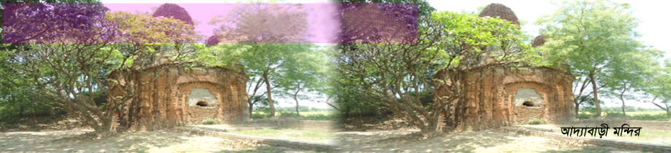
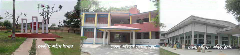
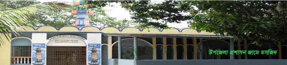
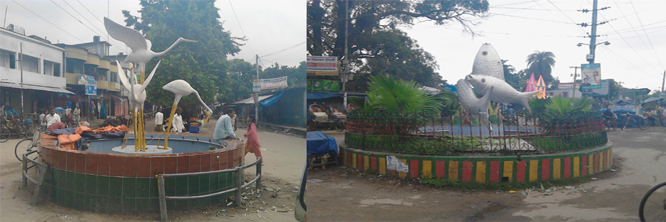
Among the historic signs of the upazila, the ancient Rajbari-present Jahangirpur Government College adjacent Jahangirpur Government College adjacent building Adabari Temple (Khajur UP), Alta Dighi Jalmahal (Charagpur), Shibganj Kacharibari (Uttagram Sapapure Union Land Office), Alipur village of Charagpur Union, two-storied eight-room house, Mahadebpur Auto Rice Mill, Atrai River, District Council Auditorium, Central Jami Mosque Maha Part of the rich history of Devpur.
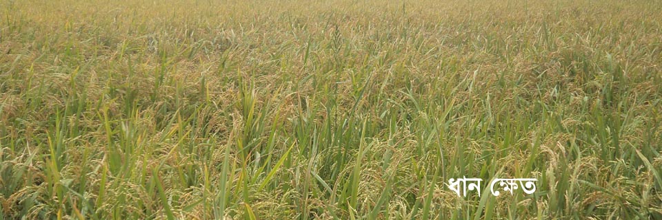
Varendra region of Mahadevpur upazila, sediment and niman region basin. Nature is formed by the plain flat terrain in the region. The ortai river flowing on one side of the upazila There are some creeks and bills that rain water flows during rainy season. At one time there were many zamindars living in this region. Tubbed chihu has not yet been completely extinct. There are lots of trees in the area. The number of Muslims in the upazila is more than that. There are many Hindu religious people in the upazila. Small ethnic groups live in six unions of the upazila. During the flooding of the floods, the plummeting areas of the upazila flooded the flood.
The number of total union of the upazila is 10.
Name of the Union:
1. Mahadevpur, 2. Khajur, 3. Enayetpur, 4 Raigon, 5 Hammer, 6. Cheragpur, 7 Candle, 8. Sappapur, 9. Uttagram, 10. Bhimpur.
Total number of mouzas: 307
Total number of villages: 298
All unions in the upazila


Planning and Implementation: Cabinet Division, A2I, BCC, DoICT and BASIS
Technical Assistance:
![]()
Developed By: